Hydrographic Survey Equipment Market Size, Growth Drivers, Application Trends, and Industry Outlook 2025–2034
PUNE, MAHARASHTRA, INDIA, February 10, 2026 /EINPresswire.com/ — Market Valuation and Growth Projection
The global Hydrographic Survey Equipment Market — a vital technology segment supporting maritime safety, ocean mapping, coastal engineering, and underwater infrastructure — is poised for significant growth over the coming decade. According to Fortune Business Insights, the market was valued at approximately USD 3.81 billion in 2025 and is projected to reach USD 6.56 billion by 2034, exhibiting a compound annual growth rate (CAGR) of 6.4% during the forecast period from 2026 to 2034.
Request a Sample PDF:
https://www.fortunebusinessinsights.com/enquiry/request-sample-pdf/hydrographic-survey-equipment-market-105220
Hydrographic survey equipment comprises advanced technologies used to measure, map, and characterize underwater environments — including seabeds, shorelines, water depths, and sub-bottom features. This equipment encompasses sonar systems (such as multibeam and side-scan sonars), positioning systems, unmanned vehicles, and supporting software that facilitate precise, high-resolution oceanographic and marine data acquisition critical for navigation, offshore energy, environmental monitoring, and infrastructure projects.
________________________________________
Market Dynamics and Growth Drivers
The rapid expansion of marine and coastal activities worldwide — including offshore energy development, port modernization, underwater construction, and environmental monitoring — is driving demand for sophisticated hydrographic survey systems. These technologies enable efficient data collection and analysis, enhancing operational planning, safety, and regulatory compliance across multiple sectors.
Key growth drivers include:
• Expansion of Offshore Infrastructure Projects: The proliferation of offshore oil and gas platforms, renewable energy installations (such as wind farms), pipelines, and cable routes increases the requirement for detailed underwater surveys, boosting investments in hydrographic survey equipment.
• Maritime Navigation Safety and Nautical Charting: Accurate hydrographic data is essential for updating nautical charts, managing maritime traffic, and ensuring safe navigation — especially in busy coastal and port regions. Government mandates and regulatory frameworks worldwide call for regular hydrographic surveys to mitigate risks associated with marine travel and trade.
• Technological Advancements and Automation: Integration of autonomous platforms such as autonomous underwater vehicles (AUVs) and unmanned surface vessels (USVs) with advanced sonar and sensor systems enhances survey efficiency, reduces operational costs, and addresses challenges associated with deep and hazardous environments.
• Environmental and Oceanographic Research: Growing interest in understanding marine ecosystems, coastal erosion, sediment dynamics, and climate change impacts is fueling demand for high-precision hydrographic survey solutions in research and scientific applications.
These combined factors are reinforcing the importance of hydrographic survey systems as foundational tools for safe, efficient, and environmentally responsible marine operations across public and private sectors.
________________________________________
Market Segmentation Analysis
The hydrographic survey equipment market can be segmented based on type, application, platform, end user, and region.
1. By Type:
Hydrographic equipment includes a range of tools and systems that capture underwater data:
• Sensing and Acoustic Systems: Core technologies such as multibeam echosounders, side-scan sonars, echo sounders, and profiling sonar units that generate detailed bathymetric and sub-bottom imagery.
• Positioning Systems: GPS/GNSS and inertial navigation systems that enable precise vessel and sensor localization for accurate mapping outcomes.
• Software and Data Processing: Specialized applications that convert raw sensor data into actionable maps, models, and visualizations used in decision-making and planning.
• Unmanned Survey Platforms: AUVs and USVs equipped with integrated sonar and sensor suites that provide cost-effective and safe alternatives to traditional crewed vessels.
2. By Application:
• Port & Harbor Management: Ensuring navigational safety, berth design, dredging planning, and infrastructure maintenance.
• Offshore Energy & Oil & Gas: Critical mapping for site selection, drilling routes, pipeline placement, and offshore installations.
• Cable & Pipeline Route Surveys: Undersea infrastructure planning for telecommunications and energy distribution systems.
• Charting & Nautical Mapping: Updating and maintaining nautical charts used by commercial and military vessels.
3. By Platform:
Hydrographic surveys are conducted using:
• Surface Vessels: Traditionally crewed vessels equipped with advanced survey arrays for broad and deepwater mapping.
• USVs & UUVs: Unmanned platforms that reduce operational risk and cost, while enhancing data collection in difficult-to-access zones.
• Aircraft: Airborne LIDAR systems for coastal shallow-water surveys where optical technologies complement sonar data.
4. By End User:
• Commercial Survey & Geospatial Companies: Firms that provide hydrographic data services to a variety of clients.
• National Hydrographic & Government Agencies: Public institutions mandated to maintain navigational safety and environmental monitoring.
• Energy & Infrastructure Developers: Developers requiring detailed seabed data for major projects.
• Defense & Naval Forces: Military entities that rely on detailed marine mapping for security and operational planning.
These segments reflect how hydrographic survey technologies serve a wide array of functions — from commercial infrastructure to scientific and defense applications.
________________________________________
Regional Market Performance
Regional adoption of hydrographic survey equipment varies based on maritime activity, infrastructure development, and investment in marine technologies.
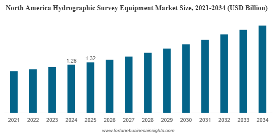
North America holds the largest share of the global hydrographic survey equipment market. The region’s dominance in 2025 is attributed to robust coastal infrastructure projects, stringent regulatory mandates for nautical charting, and ongoing investments in maritime safety and environmental monitoring initiatives. North American government agencies and private contractors frequently participate in hydrographic campaigns to support port expansions, offshore energy, and disaster preparedness strategies.
Press for an Enquiry: https://www.fortunebusinessinsights.com/enquiry/speak-to-analyst/hydrographic-survey-equipment-market-105220
The Asia Pacific market is experiencing rapid growth supported by expanding coastal development, maritime logistics improvements, and energy sector investments across countries like China, India, Japan, and Southeast Asian nations. A burgeoning maritime economy and infrastructure initiatives are driving adoption of advanced hydrographic survey systems in the region.
Latin America and Middle East & Africa are also poised for growth as offshore oil exploration, port modernization, and strategic maritime infrastructure projects continue to increase the need for detailed underwater mapping.
________________________________________
Competitive Landscape and Key Players
The hydrographic survey equipment market features established global technology providers and specialized manufacturers of survey hardware and software solutions. Companies such as Kongsberg Gruppen ASA (Norway), Teledyne Technologies Inc. (U.S.), iXblue (France), and EdgeTech (U.S.) are among prominent participants in the market, offering multi-beam echosounders,
Ashwin Arora
Fortune Business Insights™ Pvt. Ltd.
+1 833-909-2966
sales@fortunebusinessinsights.com
Legal Disclaimer:
EIN Presswire provides this news content “as is” without warranty of any kind. We do not accept any responsibility or liability
for the accuracy, content, images, videos, licenses, completeness, legality, or reliability of the information contained in this
article. If you have any complaints or copyright issues related to this article, kindly contact the author above.
![]()